
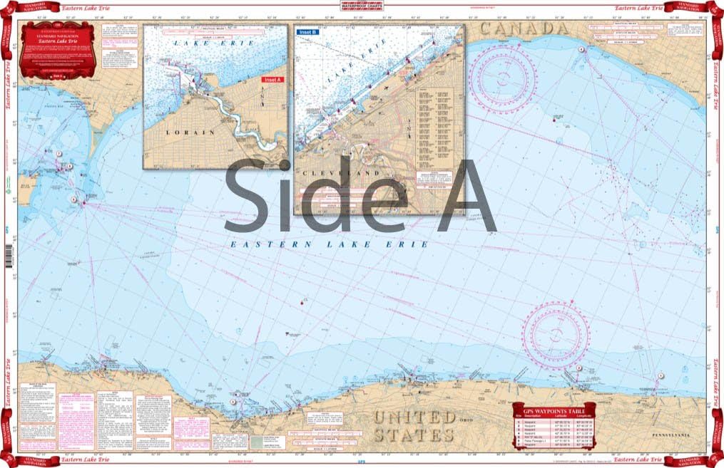
Standard Navigation, 158 Eastern Lake Erie
$38.99
Price when purchased online
Free shipping
Free 30-day returns
Sold and shipped by tech.jonoprio.com
We aim to show you accurate product information. Manufacturers, suppliers and others provide what you see here.
$38.99
Price when purchased online
Free shipping
Free 30-day returns
Sold and shipped by tech.jonoprio.com
Free 30-day returns Details
Product details
| Management number | 214525653 | Release Date | 2026/04/12 | List Price | $15.60 | Model Number | 214525653 | ||
|---|---|---|---|---|---|---|---|---|---|
| Category | |||||||||
Coverage for Eastern Lake Erie with detailed insets for Cleveland and Lorain on one side. The reverse side details the East Basin with insets of the Welland Canal and the Niagara River. Information from NOAA Charts: #14810, #14820, #14822, #14824, & #14838. Chart is 25" X 38". WGS84 - World Mercator Datum.
- Two Sided
- Foldable
- Waterproof
- Tear Resistant Synthetic Paper (Hop-Syn) 5 PP Tree Friendly
| UPC | 740399015802 |
|---|---|
| Brand Name | Waterproof Charts |
| Item Weight | 16 ounces |
| Manufacturer | Waterproof Charts |
| Paper Finish | Matte |
| Item Dimensions L x W | 25"L x 38"W |

Bestseller ranking
Charts & Maps


Correction of product information
If you notice any omissions or errors in the product information on this page, please use the correction request form below.
Correction Request Form